
The challenge
Subtle movement across steep or vegetated ground can be difficult to separate from visual noise and seasonal change.
Field project
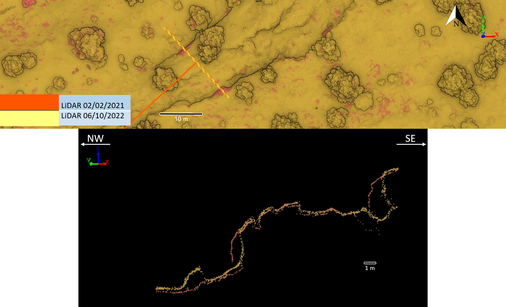
Repeat high-resolution terrain acquisition and cross-section comparison.
The challenge
Subtle movement across steep or vegetated ground can be difficult to separate from visual noise and seasonal change.
The DynamicSense intervention
DynamicSense aligned repeat LiDAR surveys to compare terrain profiles and isolate displacement in three dimensions.
Outcomes & decision support
The result is a clear monitoring layer that supports risk review, field inspection, and future comparison.
Structured outputs
Project imagery
Connected content
Consultation
We will help identify the right combination of capture, analysis, and deliverables.
Consult an expert →