
The challenge
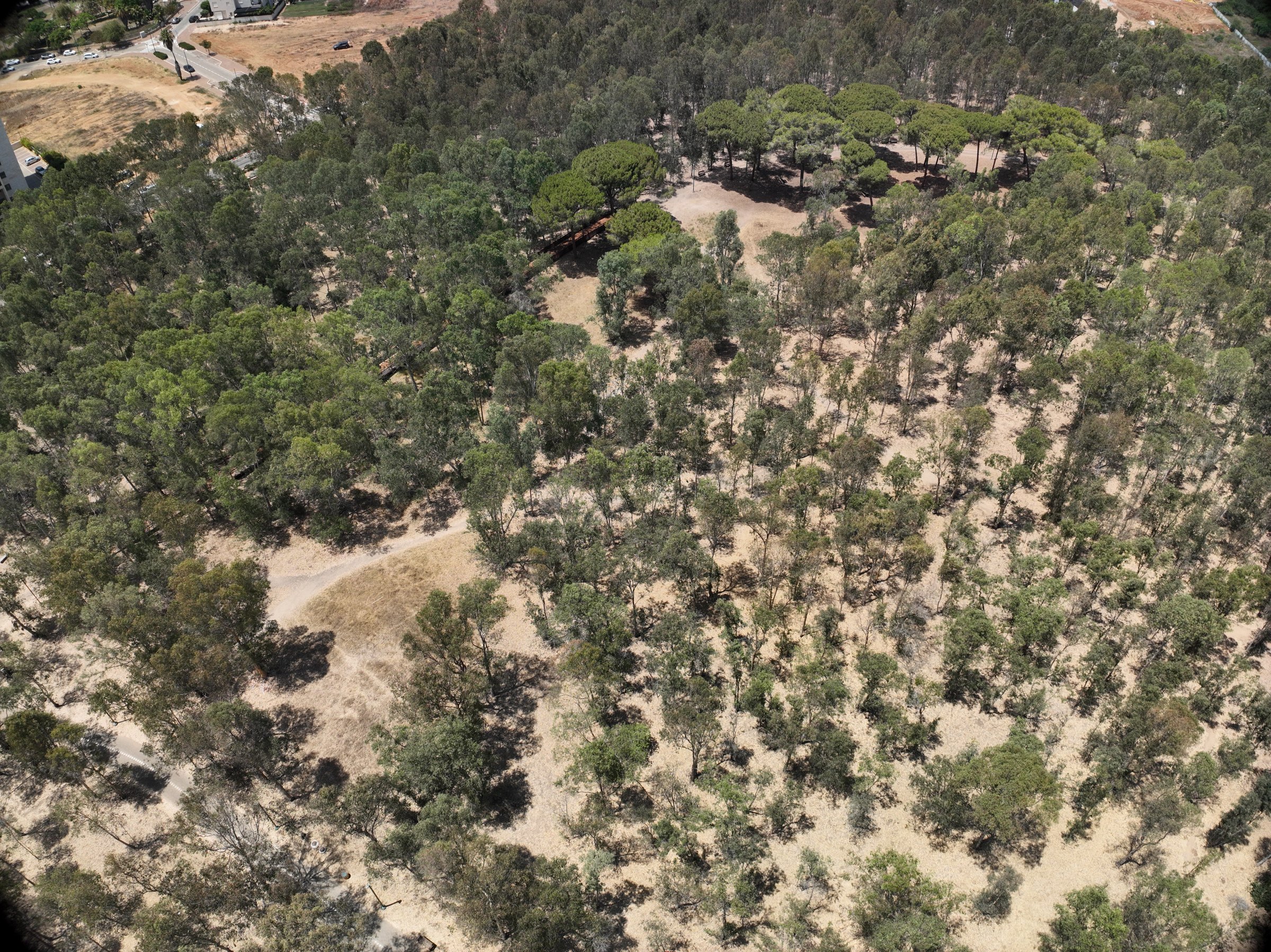
The grove’s previous survey relied on imagery alone. KKL needed direct tree heights, crown measurements and a reliable view of tree health across eucalyptus, pine and oak stands.
Field project
Drone LiDAR and multispectral survey of an urban nature grove for KKL – Jewish National Fund, mapping every individual tree and its vitality.
The challenge
The grove’s previous survey relied on imagery alone. KKL needed direct tree heights, crown measurements and a reliable view of tree health across eucalyptus, pine and oak stands.
The DynamicSense intervention
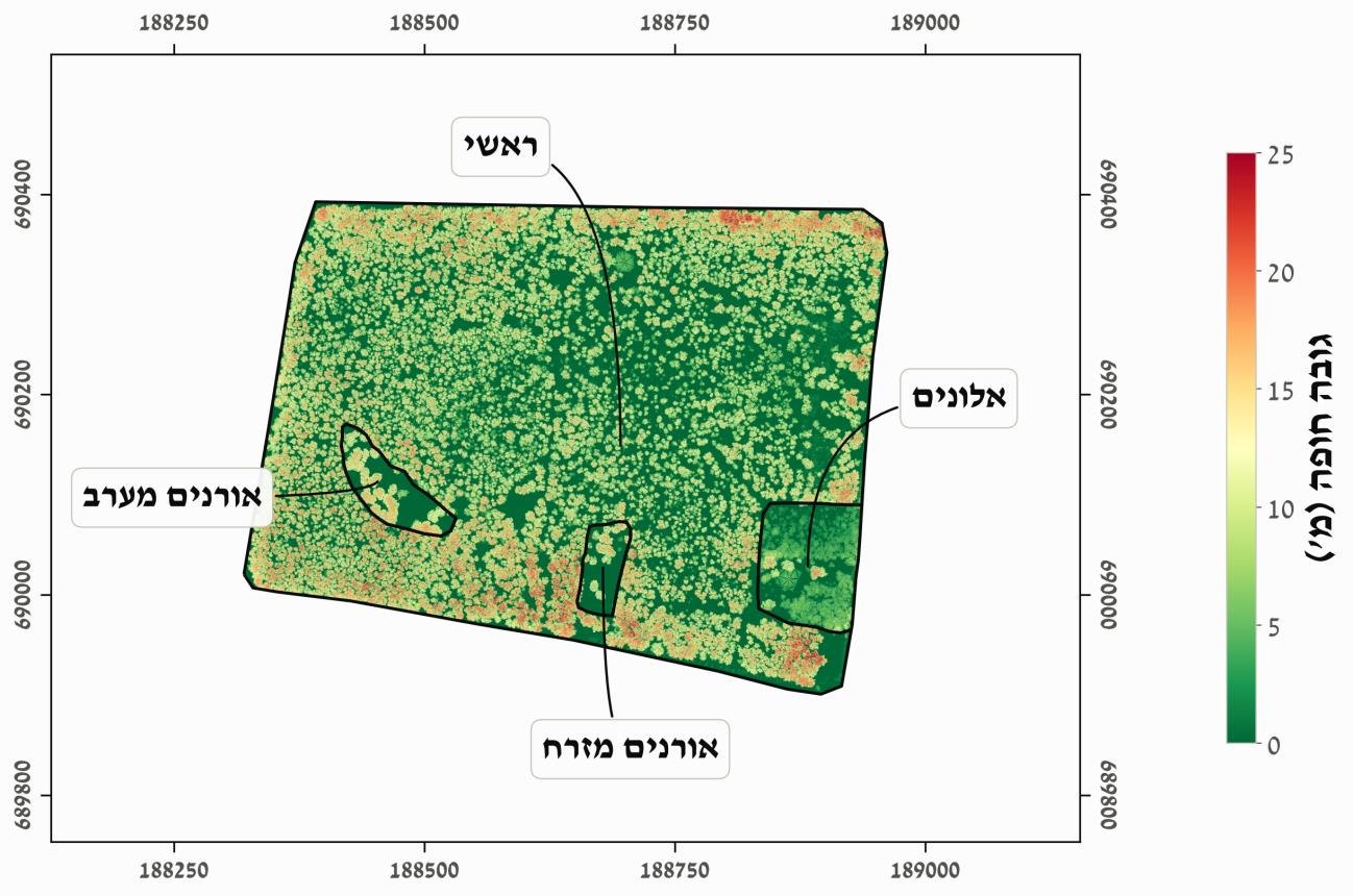
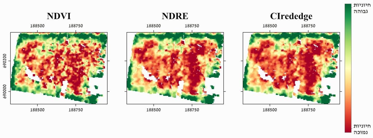
We combined drone LiDAR with a separate multispectral flight, segmented individual trees from the point cloud and linked each tree to vitality indices derived from the multispectral imagery.
Outcomes & decision support
KKL received a complete tree-level GIS layer, continuous density and canopy maps, and a clear spatial pattern of declining vitality toward the core of the eucalyptus stand, a basis for targeted management.
Structured outputs
Project imagery
Connected content
Consultation
We will help identify the right combination of capture, analysis, and deliverables.
Consult an expert →